Product Introduction
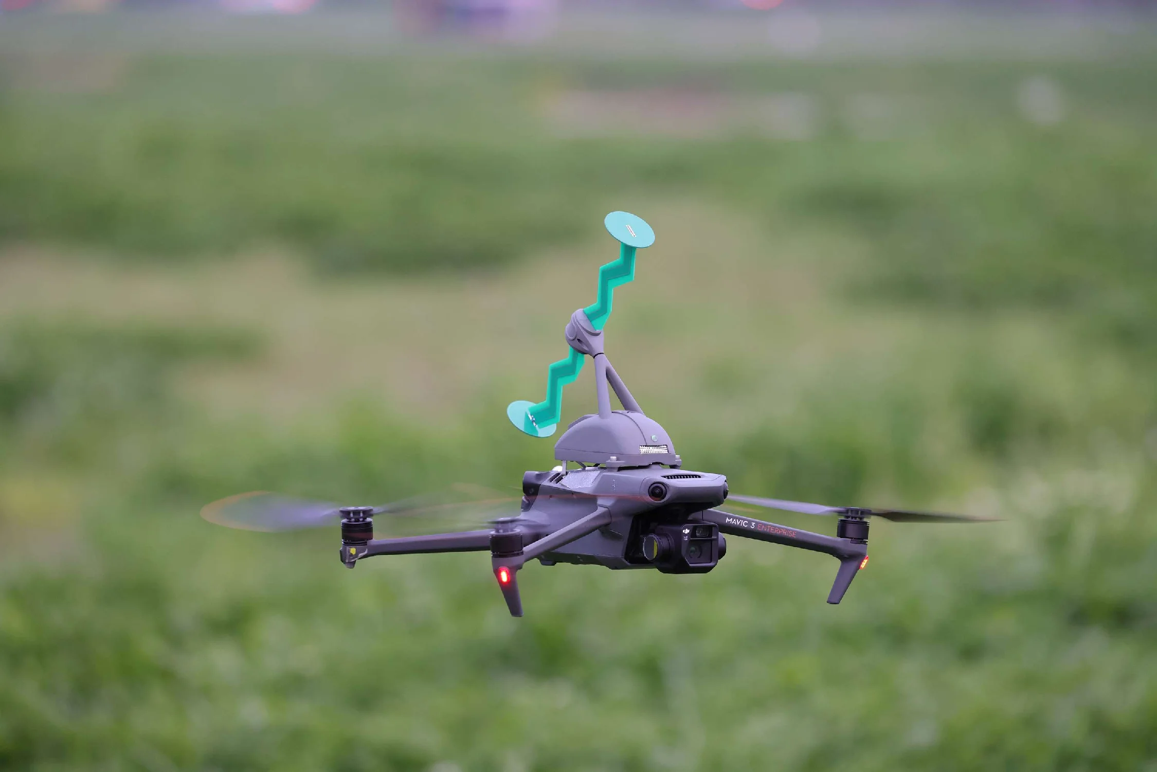
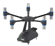
The Dragonfly series breaks new ground as the industry's first to utilize the compact DJI Mavic 3 Enterprise drone equipped with high-performance, lightweight monitoring and direction-finding payloads, creating a comprehensive spectrum monitoring system.
This highly compact system features rapid deployment and secure payload attachment, enabling a single operator to manage both flight control and radio monitoring execution. Whether navigating urban high-rise complexes or vast open regions, it can effortlessly take off with zero thresholds, precisely capturing critical signals.
With an innovative modular design, it provides exceptional airborne monitoring and direction-finding accuracy. No professional pilot license is required, delivering unprecedented tactical flexibility and mobility for spectrum enforcement teams.
Key Features
Route Planning Mode
Features two airborne route planning modes: "Path Patrol" and "Coverage", optimized for automated spectrum mapping along critical corridors, transportation links, and complex infrastructure zones.
Frequency Preset
Preloaded with global satellite and navigation frequency points for rapid mission setup. Supports full customization, modification, and database adjustments for user-defined frequency parameters.
Multi-Device Sync
Enables highly flexible simultaneous operations using both the integrated handheld remote controller and field laptops, allowing multiple stations to sync and monitor live data tasks anywhere.
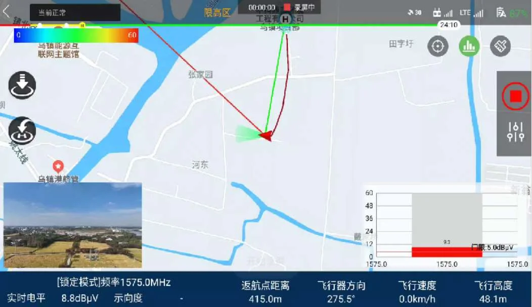
Electromagnetic Situation Map
Integrates precise geographic metadata to render flight path signal strength distributions and automatically compile comprehensive regional spectrum situation heatmaps.
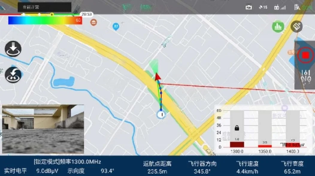
Single-Station Localization
Fuses real-time dynamic flight trajectory tracking with continuous multi-position direction-finding data, utilizing intersection algorithms to rapidly isolate target signal sources.
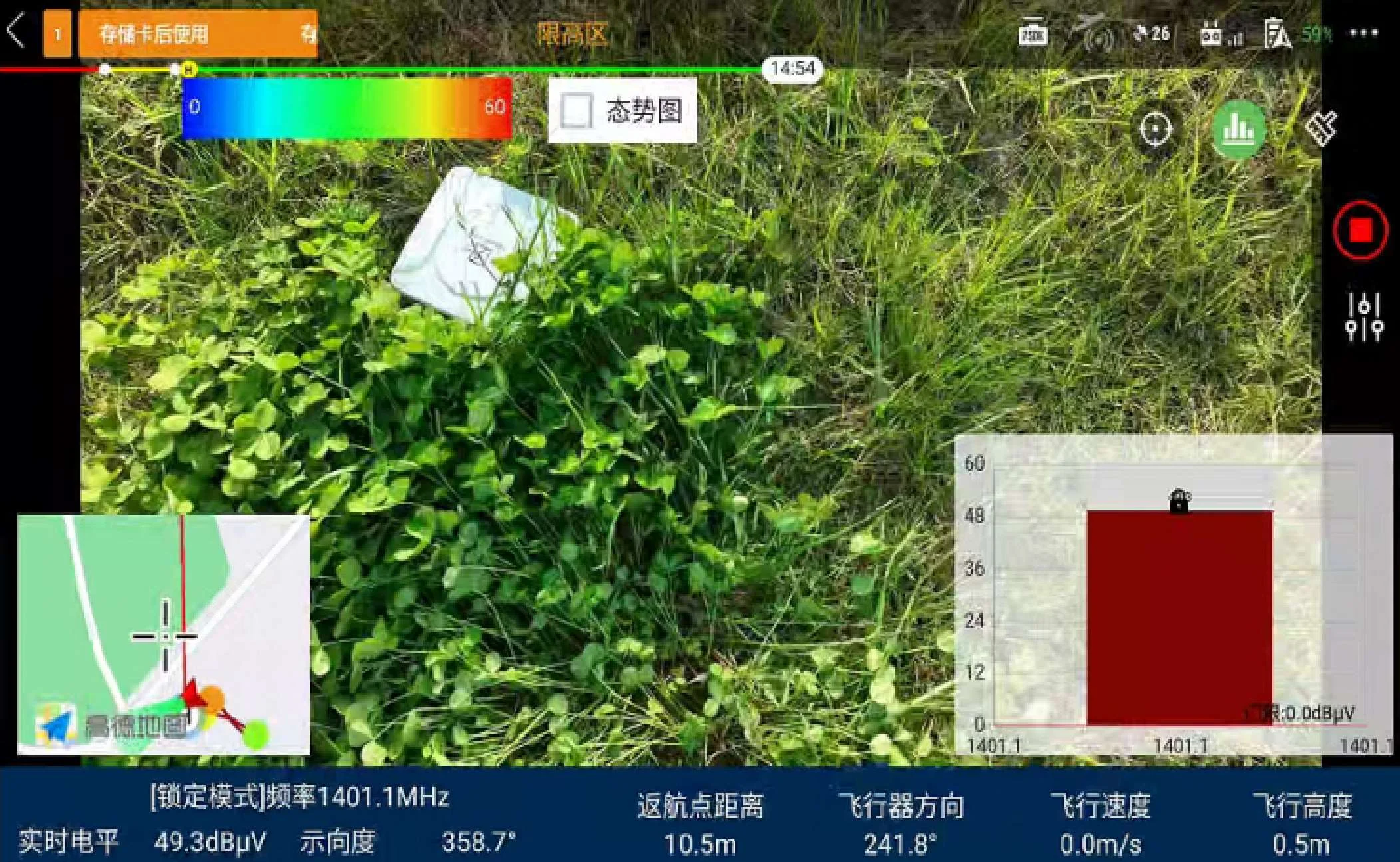
Aerial Forensics
Leverages airborne high-definition imaging for live video feeds, directly correlating optical footage with live signal parameters to document and evidence non-compliant spectral emissions instantly.
Application Scenarios
Spectrum Compliance & Safety
- Routine spectrum monitoring and high-efficiency signal detection.
- Mapping of regional and high-altitude electromagnetic spectrum environments.
- Satellite communication signal detection and skyward validation tasks.
Interference Investigation
- Precise localization and tracking of complex GNSS signal interference sources.
- Rapid mobile identification of anomalous or illegal transmissions.
- Providing critical frequency protection diagnostics for vital network hubs.
Security & Perimeter Operations
- Radio environment protection support for major local events.
- Long-range border patrol and remote area frequency activity assessments.
- Providing automated spectrum enforcement support for compliance teams.
Core System Functions
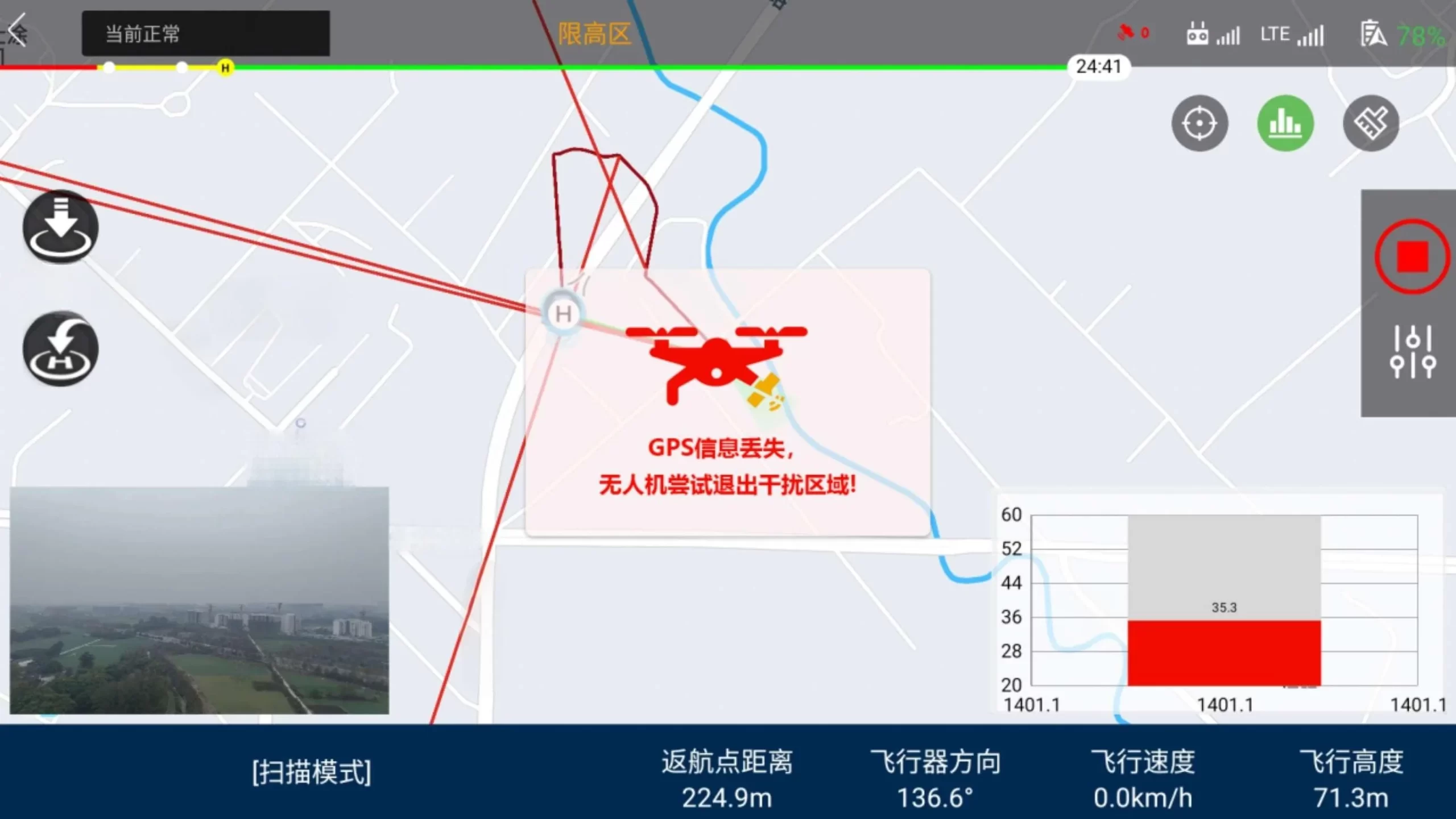
Track-Return Home
When the drone encounters severe GNSS signal interference, the system automatically takes over flight control. Utilizing real-time stored flight trajectory and attitude records combined with compass-based inertial navigation, it ensures the drone safely exits the interference area, plans optimal flight paths, and models the boundaries of the interference area.
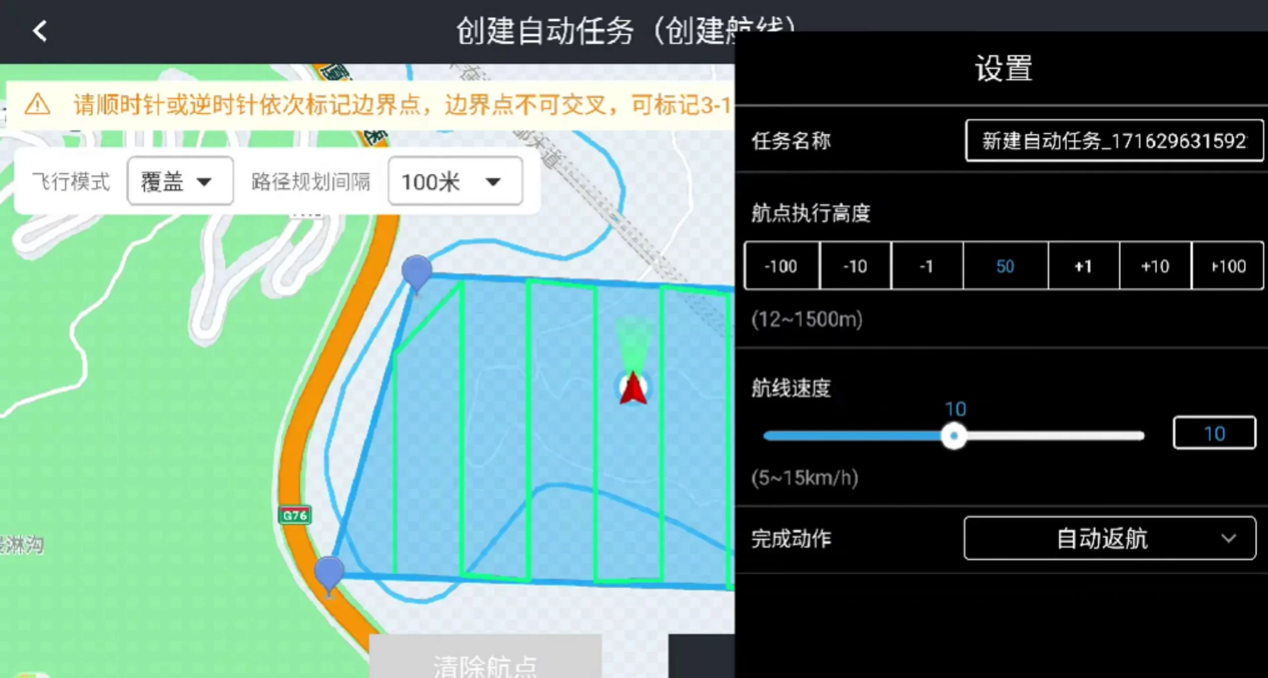
Auto Route Planning
Click the screen to select the monitoring area of interest on the map, set the monitoring frequency band and flight parameters, and generate a flight route to perform spectrum mapping. Capable of measuring multiple signals simultaneously. Additionally, flight intervals can be configured to create full coverage flight plans seamlessly.
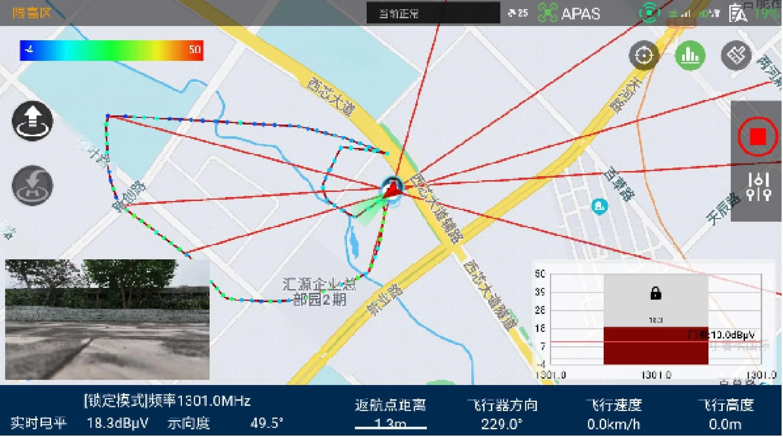
Intersection Localization
During the direction-finding process, the system transmits the direction-finding results for the current frequency point in real time. By maintaining the bearing line and dynamically tracking the drone's position, it quickly extracts the location information of the intersection point on the electronic map with high precision.
Electromagnetic Situation Analysis
Based on the collected electromagnetic environment data, combined with geographic location information for precise analysis, the electromagnetic situation of specific frequency points is visualized as a heatmap. It features complete three-dimensional electromagnetic situation modeling capabilities for comprehensive awareness.
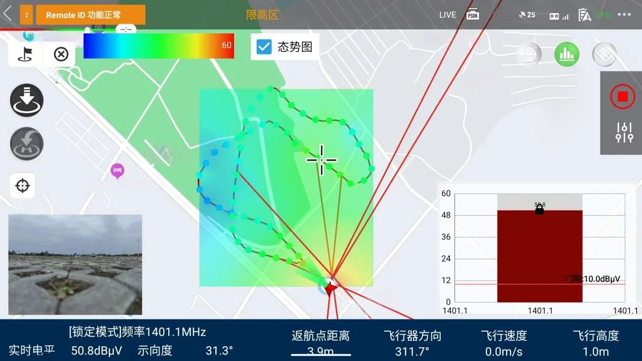
Signal Level Trajectory
Precisely captures frequency signal level variations. The system transmits real-time target frequency data and integrates it with maps, dynamically displaying it as trajectory points. Point colors intelligently adjust based on signal strength values following a visual gradient distribution layout.
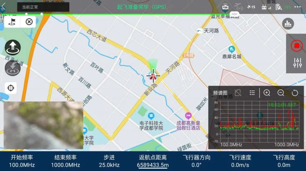
Spectrum Scanning
Provides full-band high-speed scanning coverage, meeting signal detection needs across various application scenarios. Through touchscreen operation, users can easily slide the vertical axis to review signal strength levels, freely select and zoom in on specific frequency ranges precisely.
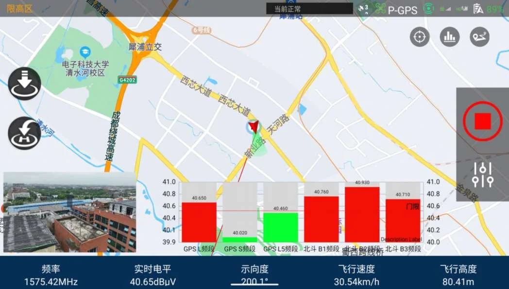
Discrete Scanning
Measures signal strength for one or multiple frequencies simultaneously based on a preset frequency list and analysis bandwidth. In environments with dense urban signal interference or forest canopy obstruction, airborne monitoring signals demonstrate excellent stability and reliability.
Single-Frequency Direction Finding
Performs rapid in-flight direction-finding executions on targeted static or fixed frequency signals. The onboard processor rapidly calculates signal arrival angles via advanced correlation interferometry methods and plots accurate bearing vectors on map screens.
Multi-View Work Mode
Switch configuration modes flexibly via absolute real-time multi-device synchronization. The architecture allows mission parameters and spectral streams to be viewed concurrently across drone controllers, mobile terminals, or centralized field base stations.

Real-Time Forensics
Leverages drone HD imaging and live video streaming to provide forensic support. With a single click for screenshots or recording, the monitoring interface integrates signal measurements to aerial-document suspect devices' appearance and precise locations.
Technical Specifications

Monitoring Payload
Frequency Range: 100MHz ~ 1GHz
Monitoring Payload
Frequency Range: 1GHz ~ 6GHz
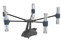
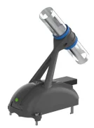
Direction Finding Payload
Frequency Range: 800MHz ~ 2GHz
Direction Finding Payload
Frequency Range: 2GHz ~ 6GHz

DJI Mavic 3 Enterprise
Flight Platform: 1 unit
| Technical Indicator Names | Technical Requirements & Specifications |
|---|---|
| RF Operational Parameters | |
| Monitoring Frequency Range | 100MHz ~ 6GHz |
| Direction Finding Frequency Range | 800MHz ~ 6GHz |
| Maximum IF Bandwidth | 20MHz |
| Direction Finding Mechanism | Correlation Interferometer Direction Finding |
| Number of Channels | 2 channels |
| Array Element Count | 5 elements |
| Performance Accuracy & Sensitivity | |
| Monitoring Sensitivity | ≤ 30 dBuV/m |
| Direction Finding Sensitivity | ≤ 35 dBuV/m |
| Instantaneous Dynamic Range | 70dB |
| Maximum Dynamic Range | 100dB |
| Level Measurement Accuracy | ≤ ±3dB |
| Direction Finding Accuracy | ≤ 5° (R.M.S.) |
| Noise Figure | 3dB |
| Physical & Aviation Indicators | |
| Payload Weight | Monitoring: approx. 160g / Direction Finding: approx. 180g |
| Flight Time / Endurance | ≥ 30 minutes |
| Power Consumption | < 6W |
| Dimensions (Monitoring) | 182mm × 65mm × 197mm / 139mm × 65mm × 154mm |
| Dimensions (Direction Finding) | 145mm × 388mm × 388mm / 140mm × 240mm × 240mm |
| GNSS Systems Support | Multi-mode global navigation support: BeiDou, GPS, GLONASS, Galileo |
| Environmental Tolerances | |
| Operating Temperature | -15°C ~ 65°C |
| Humidity | ≤ 70% |
| Wind Resistance | Operates normally in 6-level winds |
Options & Accessories
| Model | Name / Description |
|---|---|
| Standard RF Payload Packages | |
| Monitoring Payload (Low-Band) | 100MHz ~ 1GHz |
| Monitoring Payload (High-Band) | 1GHz ~ 6GHz |
| Direction Finding Payload (VHF/UHF) | 800MHz ~ 2GHz |
| Direction Finding Payload (Broadband) | 2GHz ~ 6GHz |
| Flight Platform Base Component | |
| DJI Mavic 3 Enterprise Drone | 1 unit |